الذكاء الاصطناعي في البيانات الجغرافية المكانية: استكشاف قدرات ChatGPT كأداة لتوليد حالات الاستخدام (الجزء 2)

Welcome back to the second instalment in our exciting blog series, where we dive into the world of use case generation with ChatGPT for various industries. After a thrilling start with ChatGPT’s brainstorming capabilities on الذكاء الاصطناعي في قطاع السيارات: استكشاف قدرات ChatGPT كأداة لتوليد حالات الاستخدام (الجزء 1)، نضع الآن أنظارنا على الذكاء الاصطناعي في صناعة البيانات الجغرافية المكانية.
تقنية المعلومات الجغرافية المكانية لا تقل عن كونها سحرية؛ فهي تزودنا بالأدوات اللازمة لتصور وقياس و تحليل خصائص الأرض, empowering decision-makers and transforming industries as varied as agriculture, logistics, and disaster management. The integration of Artificial Intelligence into geospatial technology brings a new era of solutions and services.
In this article, we’ll be leveraging ChatGPT to generate a medley of innovative ideas tailored for the geospatial AI industry. We aim to explore how blending large language models and deep learning with spatial data and geospatial analysis can contribute to smarter, more efficient, and sustainable solutions in various domains, such as urban planning, disaster management, resource allocation, or environmental protection. Similar to our previous article, the content generated by ChatGPT will remain unaltered, and we will interlace it with our insights, perspectives, and experiences to shed light on the practicality and ingenuity of the ideas.
توليد حالات استخدام للذكاء الاصطناعي في المجال الجغرافي المكاني
العنوان: تحويل صناعة البيانات الجغرافية المكانية: حالات استخدام الذكاء الاصطناعي لرؤية الحاسوب وتحليلات النصوص ومعالجة اللغة الطبيعية والتعلم الآلي ومحركات التوصية
المقدمة:
Artificial Intelligence (AI) has emerged as a game-changer in various industries, and the geospatial sector is no exception. Leveraging cutting-edge technologies such as computer vision, text analytics and natural language processing (NLP), machine learning, and recommendation engines, AI is revolutionizing how geospatial data is collected, analyzed, and utilized. In this article, we will explore the diverse applications of AI in geospatial technology, highlighting four to five examples for each technology area.
رؤية حاسوبية مدعومة بالذكاء الاصطناعي:
Computer vision technology enables machines to interpret and understand visual data, providing valuable insights for the geospatial AI industry. Here are some notable geospatial artificial intelligence (geoAI) use cases:
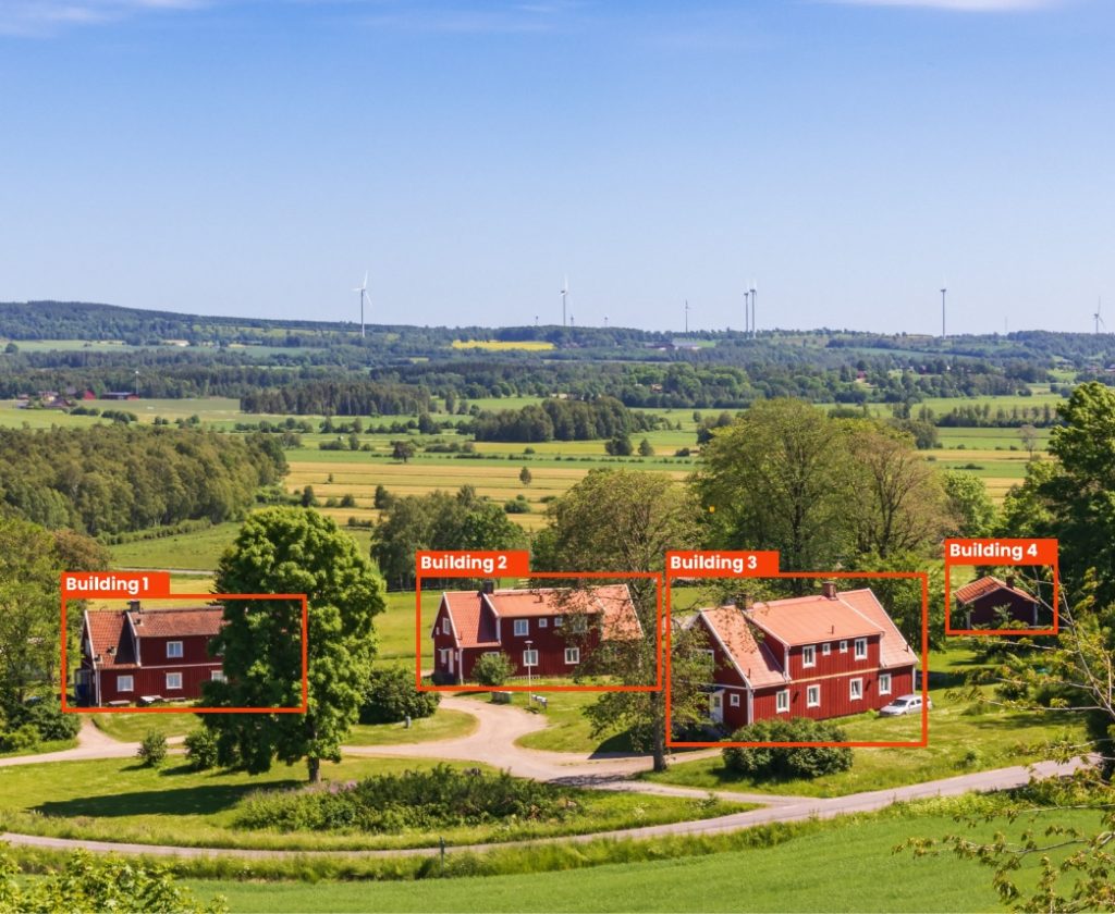
- كشف الأشياء والتعرف عليها: Artificial intellignece algorithms can accurately identify and classify objects within geospatial imagery, enabling applications like automatic vehicle counting, infrastructure inspection, and land cover analysis.
- تجزئة الصور: AI-based image segmentation allows precise identification and extraction of specific features within geospatial images, enabling applications such as urban planning, vegetation analysis, and flood mapping.
- كشف التغييرات: من خلال تحليل الصور الفضائية والجوية التاريخية والحالية، يمكن للذكاء الاصطناعي اكتشاف التغيرات بمرور الوقت، مما يساعد في المراقبة البيئية والاستجابة للكوارث وتحليل النمو الحضري.
- كشف العيوب: يمكن لخوارزميات الذكاء الاصطناعي تحليل الصور الجغرافية المكانية لتحديد العيوب في البنية التحتية، مثل الشقوق في الطرق أو المباني، مما يتيح صيانة فعالة وإدارة الأصول.
- كشف الشذوذ: بالاستفادة من الرؤية الحاسوبية، يمكن للذكاء الاصطناعي اكتشاف الحالات الشاذة في البيانات الجغرافية المكانية، مما يساعد على تحديد المخالفات مثل الأنشطة غير القانونية أو التعديات أو أنماط المرور غير الطبيعية.
تحليلات النصوص ومعالجة اللغة الطبيعية لتحسين التحليل الجغرافي المكاني:
Text analytics and natural language processing techniques enable the geospatial industry to extract valuable insights from unstructured textual data. Consider the following geospatial artificial intelligence (geoAI) use cases:
- استخلاص البيانات الجغرافية المكانية: يمكن لخوارزميات معالجة اللغة الطبيعية استخراج معلومات محددة الموقع من مصادر نصية مثل خلاصات وسائل التواصل الاجتماعي أو المقالات الإخبارية أو مراجعات العملاء، مما يسهل التحليل الجيومكاني واتخاذ القرارات.
- تحليل المشاعر: يمكن لتحليل المشاعر المدعوم بالذكاء الاصطناعي تقييم الرأي العام تجاه مواقع أو أحداث محددة، مما يساعد في التخطيط الحضري وإدارة السياحة ومراقبة الرأي العام.
- التعرف على الكيانات المسماة: يمكن لتقنيات NLP تحديد واستخراج كيانات محددة مثل أسماء الأماكن أو العناوين أو المعالم من النص غير المهيكل، مما يتيح الترميز الجغرافي والوسم الجغرافي والخدمات القائمة على الموقع.
- ترجمة اللغة: تتيح الترجمة اللغوية المدعومة بالذكاء الاصطناعي الترجمة الفورية للبيانات متعددة اللغات، مما يسهّل التواصل بين الثقافات وتحليل المعلومات الجغرافية المكانية العالمية.
- معالجة الاستعلامات الجغرافية المكانية: تُمكّن أنظمة معالجة الاستعلامات القائمة على NLP المستخدمين من استخراج المعلومات الجغرافية المكانية من خلال طرح أسئلة باللغة الطبيعية، مما يحسّن إمكانية الوصول إلى البيانات الجغرافية المكانية وقابلية استخدامها.
تعلم الآلة للتحليل المكاني:
تتيح خوارزميات التعلم الآلي تحليل البيانات الجغرافية المكانية، والتعرف على الأنماط، والتنبؤات الدقيقة. إليك بعض حالات الاستخدام المقنعة للذكاء الاصطناعي ضمن صناعة البيانات الجغرافية المكانية:
- التحليل التنبؤي الجغرافي المكاني: من خلال الاستفادة من البيانات الجغرافية المكانية التاريخية، يمكن لنماذج التعلم الآلي التنبؤ بنتائج مثل الازدحام المروري أو تفشي الأمراض أو تغيرات استخدام الأراضي، مما يساعد في اتخاذ قرارات استباقية.
- التجميع المكاني: يمكن لخوارزميات تعلم الآلة تحديد التجمعات المكانية ضمن مجموعات البيانات الجغرافية المكانية، مما يساعد على كشف الأنماط المكانية، ورصد النقاط الساخنة، وتحسين تخصيص الموارد.
- دمج البيانات الجغرافية المكانية: يمكن لتقنيات التعلم الآلي دمج مجموعات البيانات الجغرافية المكانية غير المتجانسة من مصادر متعددة، مما يسهل توحيد البيانات والاستيفاء المكاني ودعم اتخاذ القرار بشكل أفضل.
- تصنيف الصور الجغرافية المكانية: ML and deep learning models can classify satellite or aerial imagery into different land cover types, enabling applications such as environmental monitoring, precision agriculture, and forestry management.
- ضغط البيانات الجغرافية المكانية: Machine learning algorithms can optimize the storage and transmission of spatial data by identifying patterns and reducing redundancy, leading to more efficient data management and faster data processing.
محركات التوصية للذكاء الاصطناعي الجغرافي المكاني:
Recommendation engines can leverage geospatial AI to provide personalized recommendations based on user preferences, geospatial data, and spatial analysis. Here are some notable applications within the geospatial industry:
- التوصيات القائمة على الموقع: يمكن لمحركات التوصية المدعومة بتقنية AI اقتراح نقاط الاهتمام أو المطاعم أو المعالم السياحية أو الخدمات ذات الصلة بناءً على موقع المستخدم وتفضيلاته وبياناته السابقة.
- تحسين المسارات: By analysing spatial data and user preferences, recommendation engines can provide optimal routes for navigation, considering factors like traffic congestion, road conditions, and user preferences for scenic or efficient routes.
- تخطيط السفر المخصّص: يمكن لمحركات التوصية اقتراح مسارات سفر مخصصة، مع مراعاة اهتمامات المستخدم وقيود الوقت والبيانات الجغرافية المكانية، مما يعزز تجربة تخطيط السفر.
- اختيار قطعة الأرض: AI-driven recommendation engines can assist in land parcel selection for specific purposes like real estate development, infrastructure projects, or conservation efforts, considering factors such as soil quality, accessibility, and environmental considerations.
- الترشيح التعاوني للبيانات الجغرافية المكانية: Similar to how recommendation engines work for movies or products, AI-powered collaborative filtering techniques can recommend geospatial datasets, layers, or maps based on user preferences and behavior, enhancing data discovery and exploration.
الخاتمة:
The geospatial industry is undergoing a remarkable transformation through the integration of AI technologies such as computer vision, text analytics and NLP, machine learning, and recommendation engines. From enhanced data analysis and interpretation to improved decision-making and personalized recommendations, AI is revolutionizing how spatial data is utilized. By harnessing the power of these technologies, organizations and professionals in the geospatial field can unlock new insights, drive efficiency, and make informed, data-driven decisions for a wide range of applications, from urban planning and environmental monitoring to transportation optimization and personalized travel experiences.
Remember, AI is a rapidly evolving field, and as technology progresses, we can expect even more exciting use cases and advancements within the geospatial AI industry. By staying at the forefront of AI innovations and leveraging its potential, we can unlock the full power of geospatial data analysis, overcome future challenges and create a smarter and more sustainable future.
تعليقنا على حالات استخدام الذكاء الاصطناعي الجغرافي المكاني
ChatGPT generates 4-5 possible uses of artificial intelligence across computer vision, NLP and text analytics, ML and recommendation engines in the geospatial industry. And just like the last time, they are not very original.
The computer vision examples generated by ChatGPT are common in the industry. We took part in quantifying the impact of mining sites on the environment: water quality, vegetation condition and land cover changes while building the TerraEye منصة مع أحد عملائنا – FourPoint. What differentiates FourPoint is the usage of spatial data fusion techniques. By combining data from different satellite sensors, their computer vision models achieve greater accuracy than models trained solely on single sensor data.
There is a trade-off there, though – the complexity of data ingestion and inference pipelines grows. By managing the pipelines in a smart way, FourPoint is able to reuse the components in other areas, such as measuring land subsidence with millimetre scale precision by leveraging InSAR processing.
بالنسبة لمعالجة اللغة الطبيعية (NLP) وتحليلات النصوص، يقدم ChatGPT بعض حالات الاستخدام الأكثر شهرة. تُعد مهام التعرف على الكيانات المسماة (NER) وتحليل المشاعر والترجمة معروفة جيداً. يمكنك قراءة المزيد عن تحليل المشاعر هنا: تحليل مشاعر العملاء: وسيلة لتحسين استراتيجية أعمالك.
By chaining those functionalities together, some truly amazing things can be achieved. For example, satellite constellation operators often have an option for their satellites to be tasked to monitor specified areas. They can watch social media feeds and news outlets in order to pre-task the satellites to start image acquisition as soon as a major event is mentioned in the media. This ranges from natural disasters and military operations to large-scale public events. By leveraging NLP in this way, they can acquire the data before anyone even asks for it, which would give them an advantage in the market.
لدينا خبرة في بناء نماذج كشف الأحداث وتصنيفها وكذلك استخراج الكيانات من النص. اقرأ هذا دراسة حالة لمعرفة المزيد.
Another use-case mentioned by ChatGPT is Geospatial Query Processing. Using natural language to query the data has been a challenge up until recently. With the revolution that’s happening now thanks to the Large Language Models (LLMs) such as OpenAI’s ChatGPT, GPT-4 and Google’s BARD it has now become possible to greatly enhance the user experience by providing actual, well formatted answers to user questions – something that Microsoft’s Bing browser integration with GPT-4 is now providing. By indexing company documents and synthetising the answer using LLMs companies can provide a much nicer experience for their users. We’ve recently expanded our تحليل النصوص ومعالجة اللغة الطبيعية عرض يتضمن الذكاء الاصطناعي التوليدي.
اعرف المزيد عن خدماتنا الجغرافية المكانية
عرض المزيد
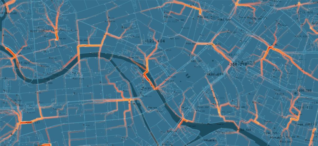
The ML use-cases are more interesting. Traffic congestion estimation is something that Google Maps and TomTom Navigation systems are offering. Using complex datasets and billions of geo-located data points every day they require both very fast and very accurate models. Temporal Graph Neural networks are currently state-of-the-art here. Spatial clustering and image classification is something we actively do with our الشركاء والعملاء.
The recommendation engines section generated by ChatGPT presents valid although not too original use cases. Personalised Travel Planning sounds similar to the GetOutside application, that we helped develop for Ordnance Survey. You can read more about it and other applications in OS’s portfolio here: Ordnance Survey: العصر الجديد لرسم الخرائط.
بعد مراجعة حالات الاستخدام المولّدة، نجدها صالحة لكنها ليست جذرية بما يكفي. دعنا نطلب من ChatGPT بعض الأفكار الإبداعية غير التقليدية بعد ذلك.
أفكار مبتكرة لاستخدام الذكاء الاصطناعي الجغرافي المكاني
إليك المزيد من حالات استخدام الذكاء الاصطناعي غير النمطية وغير التقليدية في قطاع البيانات الجغرافية المكانية:
الحفاظ على الحياة البرية بالذكاء الاصطناعي:
AI algorithms can analyze satellite imagery and sensor data to track and monitor endangered species, helping conservationists identify habitat corridors, migration patterns, and potential threats to wildlife populations. By leveraging AI, geospatial data, and deep learning models, researchers can gain insights into animal behavior, population dynamics, and ecological changes, contributing to more effective conservation efforts.
تحليل سليم للتنمية الحضرية:
AI-powered audio recognition can process urban soundscapes captured by sensors or acoustic monitoring devices. By analysing the sounds of the city, such as traffic noise, construction activity, or emergency sirens, AI algorithms can provide valuable information for urban planning, noise pollution management, and public safety optimization. This unconventional use of AI enables the creation of more livable and sustainable cities.
الاستجابة للكوارث الطبيعية والتعافي منها:
AI can play a crucial role in disaster response and recovery efforts. Through data collection of satellite imagery, social media data, and machine learning algorithms, geospatial artificial intelligence can automatically analyze and prioritize areas affected by natural disasters, such as earthquakes, floods, or wildfires. This information can assist emergency responders in deploying resources, assessing damages, and coordinating relief efforts efficiently.
الكشف عن الأمراض الزراعية:
AI-powered analysis of satellite imagery and hyperspectral data can help identify and monitor crop diseases in agricultural fields. By analyzing subtle changes in vegetation reflectance patterns, machine learning models can detect early signs of diseases, nutrient deficiencies, or pest infestations. This enables farmers to take proactive measures, such as targeted spraying or precision farming, minimizing crop losses and optimizing agricultural practices.
تحليل المشاعر باستخدام البيانات المكانية:
By combining geospatial data with facial recognition and sentiment analysis, artificial intelligence can detect and analyze emotions expressed by individuals in specific locations. This innovative approach can provide insights into public sentiment towards events, tourist experiences, city planning, or urban environments. Government entities, tourism boards, and businesses can utilize this data to enhance visitor experiences, design urban spaces, or evaluate the impact of cultural events.
مراقبة النظام البيئي البحري:
AI and underwater robotics can revolutionize marine ecosystem monitoring. Autonomous underwater vehicles equipped with computer vision and ML algorithms can analyze underwater imagery to identify and track marine species, monitor coral reef health, or detect illegal fishing activities. This cutting-edge technology enables researchers and conservationists to gather valuable data from remote and inaccessible marine environments.
إعادة البناء التاريخي باستخدام الذكاء الاصطناعي الجغرافي المكاني:
Using historical maps, photographs, and archival data, AI algorithms can reconstruct and visualize historical landscapes, cityscapes, and archaeological sites. This allows researchers, historians, and urban planners to virtually explore and analyse past environments, understand urban development patterns, and preserve cultural heritage.
الخاتمة:
As AI technology continues to advance, the geospatial industry can explore and embrace unconventional and non-typical use cases. From wildlife conservation and urban sound analysis to agricultural disease detection and marine ecosystem monitoring, AI has the potential to unlock new insights, drive innovation, and address complex challenges in the geospatial domain. By thinking outside the box and leveraging AI’s capabilities, we can harness the power of geospatial data to create a more sustainable, efficient, and informed future.
تعليق على حالات الاستخدام غير النمطية للذكاء الاصطناعي الجغرافي
The generated out-of-the-box ideas for geospatial AI use are a bit unusual, and some of them might be unpractical or impossible to implement in the near future. The Geospatial Emotion Analysis is an interesting concept, but it yields a question about data privacy and human rights. Applications like that should be developed with responsible AI principles.
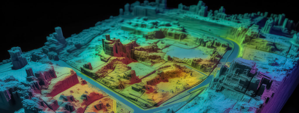
Historical Reconstruction is an area of active research. LiDAR technology is commonly used here, but the high costs of LiDAR data acquisitions, and data preprocessing or processing challenges might make it hard to quickly scale to the mass market. However, the idea that we could walk into a museum or just launch an app to go out and see how historical cities looked like is really appealing.
The other geospatial AI use cases mentioned by ChatGPT are not so imaginative and revolve around themes, such as smart agriculture, environment monitoring or natural disaster monitoring, which are all topics of active research.
خلاصة القول
As we conclude the second part of our exploration of ChatGPT’s prowess in generating use case ideas for the geospatial industry, it is essential to reflect upon what it means for the domain and the artificial intelligence ecosystem at large.
First and foremost, ChatGPT’s ability to generate use cases that are both pragmatic and innovative, albeit somewhat traditional at times, exemplifies the potential of large language models in understanding and contributing to specialised industries like geospatial AI technology. The generated ideas were varied, ranging from widely recognised applications in computer vision and NLP to more experimental propositions like Geospatial Emotion Analysis and Historical Reconstruction.
Furthermore, the capacity of ChatGPT to generate these ideas points to the promise that large language models hold as tools for ideation and problem-solving. This potential extends beyond a mere idea generation, as the utility of ChatGPT could also be harnessed in an iterative development process, where it collaborates with human expertise to refine and shape groundbreaking solutions.
It is crucial, though, to approach this potential with measured enthusiasm. Large language models like ChatGPT are tools that can catalyse innovation but are not a replacement for the nuanced understanding and domain expertise that professionals bring to the table. A synergistic approach, where AI collaborates with human ingenuity, is likely to be the most effective path forward.
In conclusion, as we look to the horizon, the integration of AI in geospatial industry holds boundless possibilities. ChatGPT serves as a reminder that sometimes the catalyst for innovation can come from unexpected quarters. Through collaboration and an open mind, the geospatial industry can harness these AI-driven geospatial insights to forge new paths and shape the future of a more connected and insightful world.
استفد من الذكاء الاصطناعي في البيانات الجغرافية المكانية مع خبراء موثوقين
The use cases outlined above are only part of the enormous potential that lies in harnessing AI for geospatial technology. Our experts specialising in both artificial intelligence and the geospatial domain can help you discover even more.
لذا، إذا كنت ترغب في مواكبة أحدث الابتكارات أوطوّر حلولك الجغرافية المكانية بتقنيات قائمة على الذكاء الاصطناعي، تواصل معنا مباشرة عبر النموذج أدناه.
الأسئلة الشائعة: الذكاء الاصطناعي في البيانات الجغرافية المكانية
Examples include environmental monitoring, precision agriculture, urban infrastructure management, and real-time disaster response. AI models can detect deforestation, analyse crop health, track wildlife, assess flood risks, or optimise logistics routes – all using satellite imagery, sensor data, or aerial maps.
The key is to start small – identify high-impact areas where automation or predictive analytics can deliver measurable results. Partnering with experts who understand both AI technologies and geospatial systems is crucial. Integration often involves combining existing GIS data with AI models for image analysis, NLP, or predictive modelling.
Key challenges include data quality and availability, computational costs, model explainability, and compliance with data privacy regulations. Another factor is the complexity of processing and harmonizing large-scale geospatial datasets from multiple sensors or formats – which requires careful system design and domain expertise.
Spyrosoft’s AI and geospatial experts help organizations design, build, and integrate AI-driven solutions tailored to their use cases. From computer vision pipelines and NLP-based geospatial search to predictive modelling and system integration, our teams turn conceptual ideas into practical, production-ready tools.




arrow_circle_rightاتصل بنا
اترك بيانات الاتصال الخاصة بك وسنعاود التواصل معك في أقرب وقت ممكن

Tomasz Smolarczyk
مدير الذكاء الاصطناعي
arrow_circle_right مقالاتنا


